Unlike a tornado or thunderstorm that can deliver destruction in minutes, El Niño exerts its influence over many months. This year, a drought accompanying El Niño has left the Amazon rainforest primed to burn, and scientists say the region has entered the early stages of what they think will be a long and severe fire season.
Starting in September 2026, satellites detected sharp increases in fire activity and smoke emissions in the central and eastern Amazon, visible in fire and emissions monitoring platforms including NASA’s Fire Information for Resource Management System (FIRMS), the Global Fire Emissions Database (GFED), and NASA Worldview. The region with elevated fire activity stretches from forests surrounding the commercial and transportation centers of Manaus and Santarém to the mouth of the Amazon River.
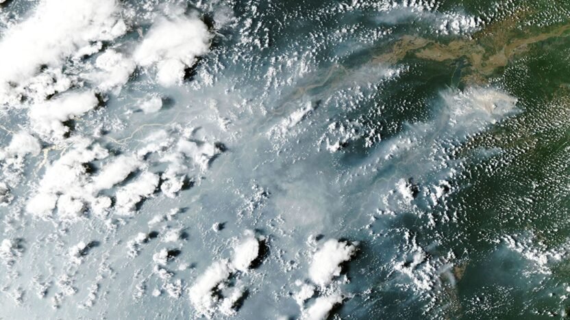
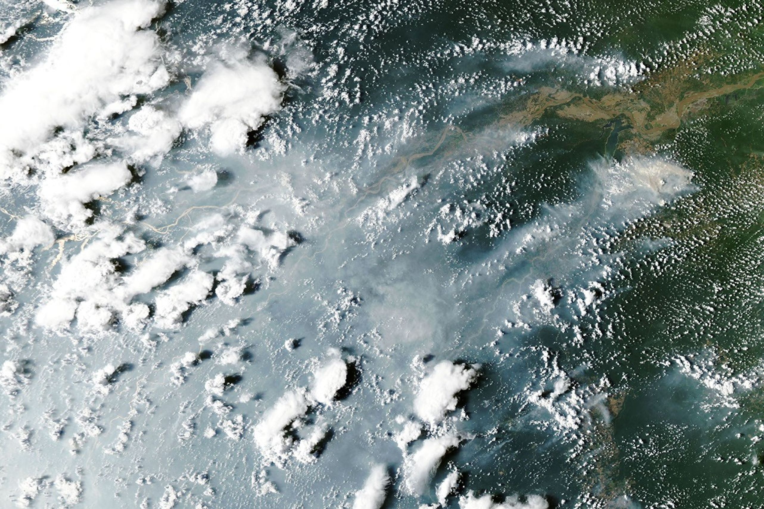
When the MODIS (Moderate Resolution Imaging Spectroradiometer) on NASA’s Aqua satellite captured this image of smoke streaming from fires on both sides of the Amazon River on October 12, 2026, heavy smoke socked in Manaus, the capital of the Brazilian state of Amazonas. That day, city officials reported extremely poor air quality, with fine particulate matter (PM2.5) values above 135 micrograms per cubic meter, the second-worst rating on a regional air quality index. The pall disrupted daily life in a city of more than 2 million people. Schools closed, and citywide events and children’s sports leagues were canceled as officials warned of hazardous air quality, according to news reports.
The burning around Santarém and Manaus is part of a “cascade” of fire in the tropics that accompanies the disrupted rainfall patterns of an El Niño, said Douglas Morton, an Earth system scientist based at NASA’s Goddard Space Flight Center. The pattern begins along the equator with drought and peat fires in Indonesia, followed by elevated fire activity in this part of the Amazon. Morton and colleagues from the University of California, Irvine; Vrije Universiteit Amsterdam; and the University of Maryland detailed the pattern in a 2017 study following the destructive fire season that accompanied the 2015–2016 El Niño. They also saw the pattern play out in 2023.
A swell of fire in the tropics riding the 2026 El Niño has followed the pattern. Drought, fire, and smoke have smothered parts of Indonesia since August, with hundreds of homes razed in October and thick smoke blanketing whole islands most days. “Now, in the Amazon, we’re seeing the second domino in the cascade fall,” Morton said, referring to the uptick in fires that has begun in Pará and Amazonas.
Morton and his colleagues expect the next wave of fire to hit farther north in November and December in the Brazilian states of Roraima, northern Pará, and Amapá, as well as parts of Venezuela, Guyana, and Suriname. Finally, around August and September 2027, he said, drought and fire risk will peak in the southern Amazon regions of Brazil and Paraguay.
“It’s so striking—and frustrating—that this is happening all over again,” said Morton, adding that many of the same forests that burned during the El Niño events in 2023 and 2015 are burning again. Forest fires in these rainforests are known to cause especially serious ecological damage because most species are not adapted to fire. It’s likely that some of the forest fires will burn even more intensely this time because the earlier fires partially charred trees, degrading the forest and making what remained more susceptible to burning, he added.
Morton expects the fires around Santarém and Manaus to continue burning until the rainy season arrives in December 2026 or January 2027. For the regions to the north and south, there is still time to prepare. “Given the intensity of this El Niño, this really is the year for people to avoid burning at all costs,” Morton said.
It’s so wet in the Brazilian Amazon that lightning ignites less than 1 percent of fires, so the vast majority of fires currently burning there were started by people, Morton said. But this year’s drought, worsened by El Niño, has been intense. Brazil’s National Institute of Meteorology reported that Manaus rainfall levels were 95 percent less than normal in August and 60 percent less than normal in September.
The large fires in this region began as management fires—clearing shrubs from pastures or crops from fields, for instance—but have escaped and are now burning freely through the parched understory of the rainforest, he added. Analysis of satellite observations indicates there are 50 to 70 uncontrolled fires burning in the Santarém region alone, said Shane Coffield, a University of Maryland assistant research scientist at NASA Goddard.
As part of a NASA Earth Action project, Coffield is mining fire observations from VIIRS (Visible Infrared Imaging Radiometer Suite) to identify fires that didn’t meet the threshold for inclusion in official data products distributed by FIRMS. He plans to share the locations of these “candidate fires” with scientists at MapBiomas, a multi-institutional network comprising universities, NGOs, and technology companies that maps fires and land-use change in the Amazon.
“For the area around Santarém, we’ve identified about 40 percent more fires than you’ll see in active fire counts from FIRMS,” said Coffield. Satellites often miss fires in circumstances like this due to dense smoke, clouds, and tree canopy cover, which can block the sensors from detecting the infrared signal of fires—especially lower-intensity fires spreading along the forest understory. “On some of the smokiest days, we have very few detections from MODIS and VIIRS, and we know that isn’t right.”
NASA Earth Observatory images by Lauren Dauphin, using MODIS data from NASA EOSDIS LANCE and GIBS/Worldview. Story by Adam Voiland.
- Associated Press (2026, October 9) Wildfires in Brazil’s Amazonas state worsen air quality in Manaus. Accessed October 14, 2026.
- Chen, Y., et al. (2026) Tracking recent extremes and interannual variability of global fire emissions using a near-real-time extension to the Global Fire Emissions Database. Earth System Science Data, preprint.
- Chen, Y., et al. (2017) A pan-tropical cascade of fire driven by El Niño/Southern Oscillation. Nature Climate Change, 7, 906–911.
- Coffield, S., et al. (2026) Leveraging additional VIIRS information to improve wildfire tracking in the western US. Remote Sensing of Environment, 115156(334).
- Coffield, S. via Google Earth Engine (2026) Fires project 403015. Accessed October 14, 2026.
- Coffield, S., et al. (2025) Tailored multi-sensor fire detection approaches to better constrain fire dynamics in tropical forests and peatlands. Accessed October 14, 2026.
- Global Fire Emissions Database (2026) Current fire situation. Accessed October 14, 2026.
- INPE (2026, October 13) Queimadas. Accessed October 14, 2026.
- Instituto Socioambiental (2026, October 9) Manaus is experiencing a horizon of smoke. Accessed October 9, 2026.
- Instituto Nacional de Meteorologia (2026, April 9) Nota sobre os Destaques Meteorológicos de agosto de 2026. Accessed October 14, 2026.
- MapBiomas (2026) Brasil. Accessed October 14, 2026.
- Ministério Público (October 13, 2026) Boletim de 11 de outubro – Risco atmosférico no Amazonas. Accessed October 14, 2026.
- NASA Fire Information for Resource Management System (October 13, 2026) Lat: -1.061°, Lon: -57.334°. Accessed October 14, 2026.
- NASA Worldview (2026, October 12) Aqua Corrected Reflectance. Accessed October 14, 2026.
- Prefeitura de Manaus (2026, October 12) Nota. Accessed October 14, 2026.
- University of Maryland (2025, December 5) Improving Wildfire Tracking with Satellite Detection. Accessed October 14, 2026.