DENVER — A group of defense and technology firms is assembling a joint effort aimed at solving a persistent problem for military users: how to access and use commercial satellite imagery and other geospatial intelligence when communications networks are unreliable or unavailable.
The initiative, called Coalition Edge, brings together companies focused on analytics, cloud infrastructure and connectivity to process and deliver intelligence directly in the field. The consortium is led by GRVTY, which specializes in geospatial analytics, and Denovo Solutions, a provider of cloud and IT infrastructure services.
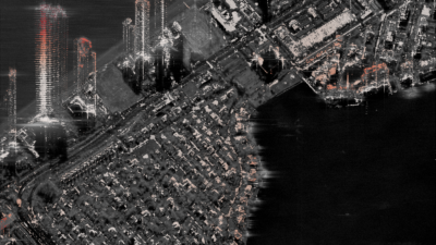
The effort comes as the military is inundated with data from commercial satellites and drones, but still struggles to access and process that information quickly enough to make it operationally useful.
Coalition Edge is built around what participants describe as an “edge intelligence stack,” a combination of computing hardware, software and networking tools designed to process data closer to where it is collected. Instead of relying on distant data centers, forward-deployed units can analyze information locally, allowing intelligence to continue flowing even when connectivity is degraded.
Nicholas Bousquet, vice president of strategy for the intelligence community at GRVTY, said the initiative reflects a need to rethink how intelligence is delivered in environments where traditional infrastructure cannot be assumed.
“With the rapidly changing environment, edge connectivity for the warfighter is especially vital,” Bousquet said. When forces are operating in austere environments, “the question is ‘how do you get assured geospatial intelligence and other intelligence into the hands of warfighters?’”
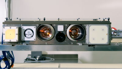
In addition to GRVTY and Denovo Solutions, the group includes Hewlett Packard Enterprise, Nvidia, Rancher Government Services, T-Mobile and Urban Sky, which operates high-altitude balloon platforms that collect intelligence.
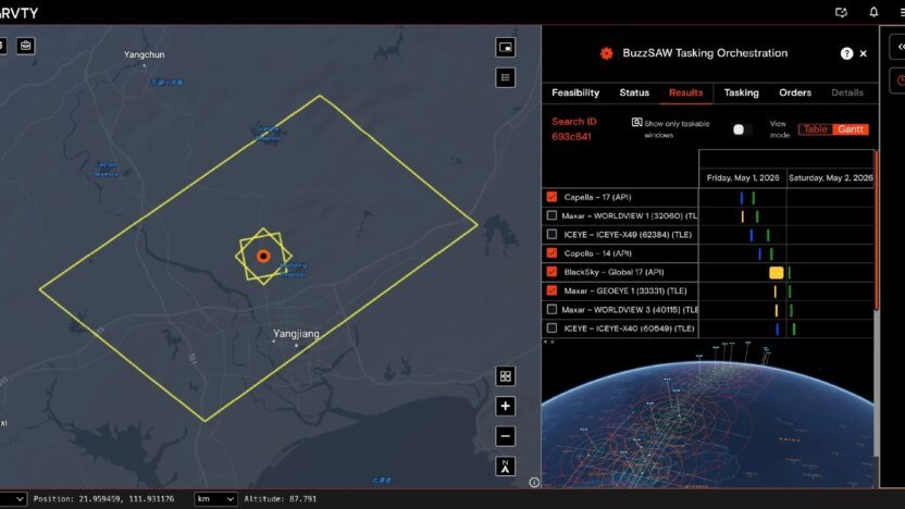
At the GEOINT Symposium, the companies are showing users how the cooperation would work, using live data streams and artificial intelligence tools to transmit and analyze information across the show floor simulating a field environment. The setup is intended to show how different layers of the system — compute hardware, preloaded data sets and AI models — can operate together without relying on fixed infrastructure.
“What we have is a layered solution,” Bousquet said. “We have hardware stacks that have pre-loaded geospatial data sets. We have AI reasoning models that are also loaded on there,” he added. “Being able to have high processing compute from places like Nvidia that are loaded onto stations that would traditionally be downrange is a huge game changer.”
The approach also leans on alternative methods of moving data. Bousquet pointed to the use of commercial cellular networks and high-altitude platforms, including full-motion video downlinks from Urban Sky balloons, with processed data fed into GRVTY’s analytics platform.
Denovo provides automated target recognition and application programming interface connectivity, intended to allow different data sources and systems to work together.
With those capabilities, Bousquet said, “you no longer have to feel like you’re at a disadvantage because you’re on the front lines.”
This type of collaboration is “exactly what industry needs to be doing,” Bousquet said. “It’s not about waiting for an RFP from the government or an RFI to start teaming. If we want to compete on the global stage against near peer competitors, industry has to self incentivize to go out and begin partnerships and invest IRAD dollars and marketing dollars … painting the art of the possible for the customers before they even know what they need.”