DENVER — IonQ said it will begin offering a satellite data product that detects subtle changes in the Earth’s surface using radar imaging spacecraft operated by its Capella Space subsidiary.
The Maryland-based company said the service is based on Interferometric Synthetic Aperture Radar, or InSAR, a technique that compares radar measurements taken over the same location at different times to identify small shifts in the ground. While the method is well established, IonQ is positioning it as a more accessible, on-demand commercial offering.
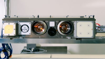
IonQ acquired Capella in May 2025. The company operates eight Capella Acadia radar imaging spacecraft in mid-inclination and sun-synchronous orbits, which provide repeat coverage of the same locations on Earth.
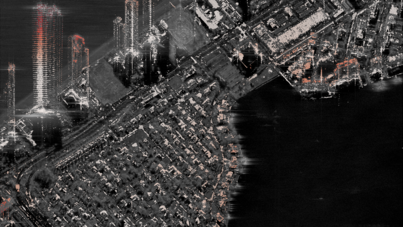
InSAR works by analyzing the phase of radar signals collected during multiple satellite passes. By measuring tiny differences in the signal return, the technique can detect ground movement with millimeter-level precision. That allows users to track changes that are not visible in conventional imagery.
The applications span several industries. Energy and mining companies use the data to monitor oil fields, pipelines and excavation sites for subsidence, a gradual sinking of the ground that can signal infrastructure risk or changes below the surface. Civil engineers apply the same approach to assess the stability of bridges, rail networks and buildings over time.
In disaster response, InSAR is used to map earthquake deformation and volcanic activity, providing early insight into damage or potential eruptions. Governments and insurers also use the data to assess flood risk and coastal erosion, particularly in low-lying urban areas where gradual land subsidence can compound storm impacts.
IonQ said its offering does not rely on new satellites but on software and processing improvements that allow customers to task existing spacecraft to collect repeat-pass radar data suitable for interferometric analysis.
“We are delivering InSAR through our data processing advancements, without requiring new satellite deployments,” a company spokesperson said. “Customers can task InSAR-ready data right away via our tasking console and API.”
In a May 4 statement, the company said the system automates what has historically been a more manual process, allowing users to schedule repeat collections and receive processed data without coordinating individual satellite passes.
The company said it tested the capability in a 2025 study over Mexico City, where it measured ground deformation rates exceeding 70 centimeters per year using 18 radar acquisitions over seven weeks. IonQ said similar datasets would typically take months to assemble using conventional approaches.