WASHINGTON — TrustPoint, a Virginia startup developing a low-Earth-orbit navigation system intended to complement or back up GPS, said May 12 it received a $4 million contract from the U.S. Space Force to demonstrate a GPS-independent positioning, navigation and timing system.
The award is a Tactical Funding Increase, or TACFI, issued through SpaceWERX, the organization that manages the Space Force’s Small Business Innovation Research contracts. TACFI programs are designed to help companies transition technologies developed under early-stage SBIR contracts into larger government programs.
Patrick Shannon, TrustPoint’s co-founder and chief executive, said TACFI awards are typically valued at around $2 million and usually require matching private investment. In this case, he said, SpaceWERX and the Space Force Commercial Space Office funded the full $4 million amount.
“That indicates a strong demand signal” for the technology, Shannon said.
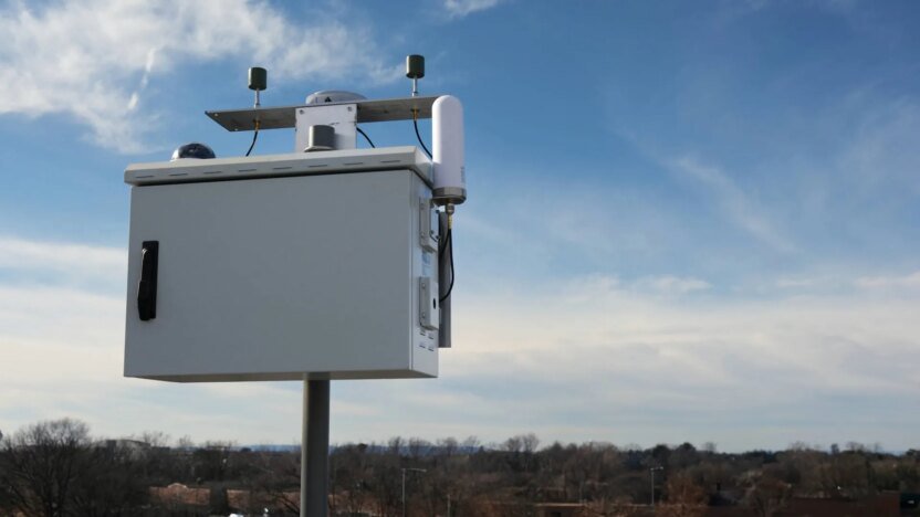
Under the contract, TrustPoint plans within the next 12 months to manufacture and deploy a four-satellite demonstration system supported by four ground stations. The effort will include a live trilateration demonstration across space and ground assets, Shannon said. This would show how signals from satellites and ground stations can be used together to calculate a user’s position.
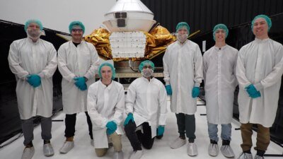
The company currently has three satellites in orbit as early demonstrators of its low-Earth-orbit positioning, navigation and timing, or PNT, network, including C-band payloads and what it describes as a GPS-independent ground architecture.
Interest in alternative PNT systems has increased in recent years as military officials and commercial satellite operators confront growing incidents of GPS interference, particularly in regions near active conflicts. Jamming and spoofing of satellite navigation signals have emerged as a concern for military operations, weapons guidance and spacecraft navigation.
TrustPoint’s approach centers on transmitting navigation signals in C-band, a higher-frequency portion of the spectrum than the L-band frequencies used by GPS.
Shannon said the combination of low-orbit satellites and higher-frequency transmissions is intended to improve resistance to interference.
“If GPS or the L-band frequencies are denied or degraded, our system will continue to operate because it’s independent,” Shannon said. “There’s no tie back to heritage GPS, and that’s what users are looking for.”
The company has also been working with suppliers on receivers designed for military platforms, Shannon said. Systems built using open standards could integrate TrustPoint’s services as a backup to GPS through plug-in hardware.
For the TACFI-funded demonstration, Shannon said the company plans to use multiple types of user equipment, including devices developed internally as well as systems from third-party vendors.